Current Research Projects
Rocky Mountain National Park, ColoradoIn collaboration with Dr. Chris Monz and Noah Creany at Utah State University, we have been helping identify indicators and develop monitoring protocols for visitor use and associated disturbance in Rocky Mountain National Park. The protocols will monitor the park's day-use visitor access system. Funding for this project was provided by the National Park Service.
This is one of many projects that the lab has collaborated on with Rocky Mountain National Park. Check out the "Past Research Projects" below for more information on past projects in this park. |
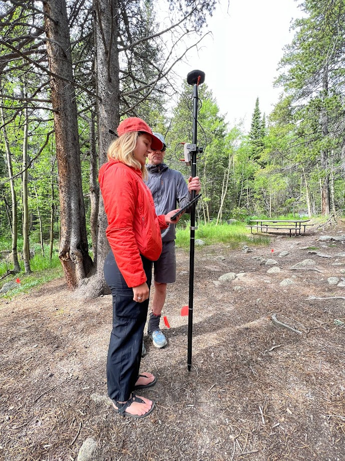
Kira Minehart and Chris Monz testing monitoring protocols near the Longs Peak trailhead.
|
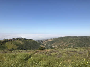
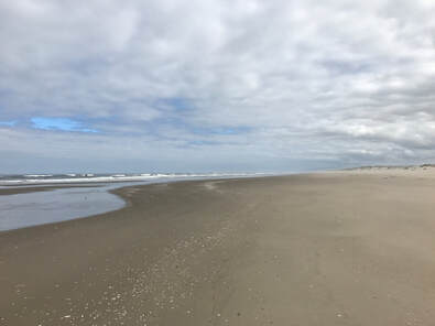
Big Bend Redwoods State Park, California
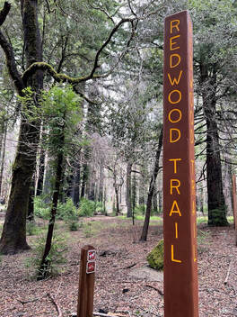 Sign for Redwood Loop Trail in Big Basin Redwoods State Park
Drs. D'Antonio, Troy Hall, and Madeline Aberg (lab Postdoc) have been collaborating with Big Basin Redwoods State Park in California on a visitor use monitoring project. We conducted field work in Big Basin Redwoods State Park in Summer 2023 to monitoring parking lot use, visitor use, and survey visitors about their experiences at and knowledge of Big Basin Redwoods State Park. Lessons learned from this project fed into a series of trainings and modules about visitor use monitoring that is available to all California State Parks. Funding from this project was provided by Parks California and California State Parks.
Blue Mesa Reservoir
|
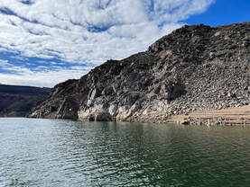
Blue Mesa Reservior
|
National Park Foundation Science Fellowship
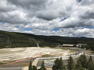 Old Faithful Area in Yellowstone National Park
In the Fall of 2019, Dr Evan Bredeweg (postdoc in our lab) and Dr. D'Antonio were awarded one of three National Park Foundation Science Fellowships to explore a current, managerial relevant social science issue facing U.S. National Parks. Our work will be examining how recreation-related infrastructure (such as roads and trails) impacts habitat connectivity and results in habitat fragmentation in Rocky Mountain and Yellowstone National Parks. We will be looking at these potential impacts at the scale of the entire protected area and helping managers prioritize management actions and understand the pattern of recreation use across the landscape. This project is in it's final phases and findings should be published soon.
Orange County, California
 Open space in Orange County, California
Despite being home to over 3 million people, Orange County, California has an important system of open space and protected areas (called the Nature Reserve). These areas, which are managed by multiple management entities, are heavily used by recreationists throughout the year. The lands are also enrolled in a Natural Communities Conservation Plan which focuses on protecting plants, wildlife, and habitats in Orange County. The biota of the Nature Reserve in Orange County has been extensively studies but little work has been done to examine recreation and any potential impacts it may be having on the ecosystems of the Nature Reserve. In 2016, with collaborators at Utah State, we began a mulit-year project to study the recreation system in Orange County California. This project is on-going with results forthcoming. Funding on this projects comes from Natural Communities Coalition. Many of our project reports and papers from this work cam be found here.
Jotunheimen National Park, Norway
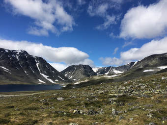 Jotunheimen National Park, Norway
During Dr. D'Antonio's postdoc at Utah State, she was fortune to be able to travel to Norway and collaborate with individuals at the University of Tromso. Cultural ecosystems services, such a plants that bear edible fruit (cloud berries, blue berries, etc.), are an important ecosystem service to residents of Norway. National parks are locations that provide both cultural ecosystems services and recreation opportunities to visitors. This project examines the overlap of cultural ecosystem services and recreation disturbances in Jotunheimen National Park - one of the most popular national parks in Norway. This research is on-going and results are forth-coming.
Past Research Projects
Minto-Brown Island Park, Salem, Oregon
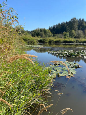 Pond at Minto-Brown Island Park which serves as important habitat for native turtles (photo by Josh Kesling).
The D’Antonio lab recently completed a multi-year research endeavor to better understand human-turtle interactions in Salem, Oregon’s Minto-Brown Island Park. Gareth Hopkins at Western Oregon University and the Oregon Department of Fisheries and Wildlife worked collaboratively on a long-term turtle restoration and monitoring methods, including habitat improvements via basking structure creation and population recovery programming. Our lab brought recreation management expertise to this collaborative endeavor. Few studies have examined potential disturbance from recreation on turtles throughout diverse freshwater habitats in a large, urban park. We observed the level and behavior of visitors to popular trails and ponds in Minto-Brown Island Park while recording turtle presence, behavior, and species. A project goal was to determine whether the park’s non-native turtle, the Red-Slider, responds to recreation disturbances differently than the native Western Pond and Painted turtle species. In addition, this study strived to ascertain how short-term recreational disturbance might impact turtle behavior, which has implications for the management strategies that best suit a healthy, balanced aquatic ecosystem for both humans and turtles. You can learn more about this project at this Leave No Trace Blog. Funding for this project was provided by the Oregon Conservation and Recreation Fund.
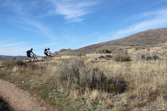
Black Rock Mountain Biking Area, Falls City, Oregon
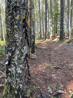 Automatic trail counter installed at Black Rock Mountain Biking Area
This was a collaborative project with the Oregon Department of Forestry (ODF) and the University of Washington (Spencer Wood and his research team). The focus of the work was to monitor recreation use at Black Rock Mountain Biking Area near Falls City, Oregon. Our lab assisted with on-site visitor use estimation using automatic trail counters and on-site visitor surveys. These on-site approaches were complementary to more remote monitoring approaches being led by the University of Washington. Our goal was to not only better understand recreation use at this popular mountain biking destination but to understand monitoring approaches that could be applicable at other ODF recreation sites. Funding for this project was provided by ODF.
Rocky Mountain National Park, Colorado
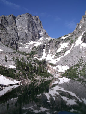 Emerald Lake, Bear Lake Road Corridor
Project 1: All of Dr. D'Antonio's M.S. research was conducted in Rocky Mountain National Park in Colorado. She worked in the Bear Lake Road Corridor of Rocky Mountain NP examining, from an ecological and social standpoint, the unintended consequences of alternative transportation systems. Vegetation surveys, social science surveys, and GPS-based tracking techniques were used to examine current resource impacts, how visitors perceive these impacts, and whether visitors are interacting with resources that they perceive as unacceptable in the Bear Lake Road Corridor.
Key Findings from Dr. D'Antonio's M.S. work:
Project 2: During the Summer of 2015, Dr. D'Antonio was able to go back to the Bear Lake Road Corridor and reexamine some of the areas that were mapped for resource impacts. Since the first study from 2008/2009, a new recreation activity became incredibly popular very quickly in the Bear Lake Road Corridor; bouldering. Bouldering inherently often requires off-trail travel and the use of crash-pads often causes vegetation damage around the base of climbs. This new project, mapped resource impacts specifically associated with bouldering activities and compared the level of impact observed in 2015 to the level of impact observed and measured in these same areas during Dr. D'Antonio's M.S. work (2008/2009). Funding for this project came from the National Park Service.
Key Findings:
Other projects: Dr. D'Antonio also assisted with study design of a project looking at the spatio-temporal impact of vehicle diversions in the Bear Lake Road Corridor.
Key Findings from Dr. D'Antonio's M.S. work:
- Visitor use is resulting in widespread ecological impact in the Bear Lake Road Corridor, especially through the formation of informal trails.
- Off-trail visitor use sites, often near lakeshores and waterfalls, receive large numbers of visitors each year.
- Visitors are sensitive to some forms of ecological impacts, especially informal trails, and GPS tracks show that many visitors are interacting with levels of resource impact that they may find unacceptable.
Project 2: During the Summer of 2015, Dr. D'Antonio was able to go back to the Bear Lake Road Corridor and reexamine some of the areas that were mapped for resource impacts. Since the first study from 2008/2009, a new recreation activity became incredibly popular very quickly in the Bear Lake Road Corridor; bouldering. Bouldering inherently often requires off-trail travel and the use of crash-pads often causes vegetation damage around the base of climbs. This new project, mapped resource impacts specifically associated with bouldering activities and compared the level of impact observed in 2015 to the level of impact observed and measured in these same areas during Dr. D'Antonio's M.S. work (2008/2009). Funding for this project came from the National Park Service.
Key Findings:
- Bouldering activities have led to significant networks of informal trails that were not present in the 2008/2009 study.
- A guide book for bouldering activities in the Bear Lake Road Corridor encourages visitors to access bouldering problems via sensitive habit, resulting in highly impacts trails and sites in some locations.
- The results were used by Rocky Mountain National Park to create an out-reach campaign targeting boulderers and to close off some of the most impacted social trails used to access the bouldering areas.
Other projects: Dr. D'Antonio also assisted with study design of a project looking at the spatio-temporal impact of vehicle diversions in the Bear Lake Road Corridor.
Swaner EcoCenter and Preserve, Utah
 Mountain bikers on Swaner Nature Preserve trails
In winter of 2010, the Swaner EcoCenter and Preserve - located in Park City, Utah - was gifted to Utah State University. Having never been associated with a university, the Swaner Preserve was lacking the resources to conduct basic inventories of their trail system and trail users. As such, from summer 2010 to summer 2011, Dr. D'Antonio conducted a small project on the Swaner Preserve examining current trail conditions, levels of visitor use, and basic visitor demographics and user types. Some of the results from the study were used to inform new signage and an interpretive plan for the Swaner Preserve.
Key Findings:
Key Findings:
- Despite high levels of visitor use, the trails on the Swaner Preserve are in good condition and there is little informal trail formation.
- The main issues at the Swaner Preserve were the presence of numerous invasive species, some visitor impacts in riparian zones, and visitors disobeying on-leash rules for dogs.
- Visitors to the Swaner Preserve are generally residents of Park City who are using the trails for exercise and to enjoy nature.
Yosemite National Park, California
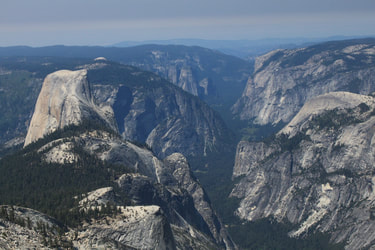 Half Dome and El Cap as viewed from Cloud's Rest
Project 1: In the Fall of 2011, Dr. D'Antonio helped to design and execute a GPS-based tracking study of visitor use in Yosemite National Park. Yosemite Valley is home to a series of beautiful and ecologically sensitive meadows. In Yosemite NP, she was interested in learning how visitors were using two meadows and understanding the level of sensitivity of meadow and forest ground cover species to trampling. In both meadows were GPS tracked visitors who were using the meadows. In a nearby meadow, Dr. D'Antonio conducted an experimental trampling study to help managers understand how the meadow plants in Yosemite NP may respond to being trampled on by visitors. Funding for this project provided by the National Park Service.
Key Findings:
Project 2: From 2020 through 2023, Dr. D'Antonio and Dr. Susie Sidder (former Ph.D. student in the lab) returned to Yosemite National Park as collaborators on a wilderness management study. We worked collaboratively with research at Penn State and Applied Trail Research to understand the camping behavior of experiences of visitors to Yosemite's vast Wilderness.
Key Findings:
- At one of the meadows, designated trails helped to reduce visitors dispersing into the meadow.
- The second meadow, did not have any designated trail, which resulted in visitors wandering around in the meadow and potentially impacting vegetation.
- Maps created from this project predicted where visitor use may cause impacts in the future by combining the maps of visitor behavior with maps of vegetation in the meadow and measures of how sensitive that vegetation is to trampling,
Project 2: From 2020 through 2023, Dr. D'Antonio and Dr. Susie Sidder (former Ph.D. student in the lab) returned to Yosemite National Park as collaborators on a wilderness management study. We worked collaboratively with research at Penn State and Applied Trail Research to understand the camping behavior of experiences of visitors to Yosemite's vast Wilderness.
Yellowstone National Park, Wyoming/Montana
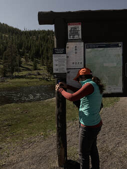 PhD student, Susie Sidder, participating in pilot repeat photography study in Yellowstone National Park.
During the summer of 2017, Dr. D'Antonio and Susie Sidder (Ph.D. student) assisted Yellowstone National Park in developing protocols to monitor visitor use that would be appropriate for data collection by Youth Conservation Corps (YCC) groups. The YCC Crews worked at a number of popular destinations in Yellowstone. The project was a huge success in the first year, with the YCC collecting high quality data on visitor use. Due to the success of the first year, this project is on-going through 2018 & 2019. After three years of monitoring data, we are hoping to be able to evaluate visitor use trends at the sites where the YCC crews have been working. In 2018 and 2019, we are also pilot testing a citizen science monitoring program using repeat photography stations set-up throughout Yellowstone NP. PhD student Susie Sidder has been taking the leader on the repeat photography component of the project. The purpose of the project is to use crowd-sourced photos to monitor change over time in Yellowstone. Results from these studies can be found at the Yellowstone's Visitor Use Management website under "Visitor Use Studies". Funding provided by the National Park Service.
Oregon Dunes National Recreation Area, Oregon
 Oregon Dunes National Recreation Area beach where Western Snowy Plovers nest and raise their young.
From 2018 through 2019, Dr. D'Antonio was a co-PI on a project focused on helping to protect the Western Snowy Plover on the Oregon Coast. Outdoor recreation use on the Oregon Coast often occurs on beaches where the threatened Western Snowy Plovers nest and raise their young. Visitor use on beaches can cause disturbance to these birds which sometimes leads to lost eggs or even chick mortality. Specifically, we worked at the Oregon Dunes National Recreation Area to monitor visitor compliance with Western Snowy Plover regulations on a number of nesting beaches. The purpose of the work was to help determine how effective the outreach and education campaign implemented by the Siuslaw National Forest was in protecting the Western Snowy Plovers during nesting and fledgling. Additionally, Carli Schoenleber (M.S. student, completed in 2019) conducted a study at the Oregon Dunes National Recreation Area. Her study examined if signs that she designed using communication theory would be more effective at increasing visitor compliance with these regulations compared to current signs found at the Oregon Dunes.
Findings from this study can be found in Carli's M.S. thesis and her first-author publication.
Findings from this study can be found in Carli's M.S. thesis and her first-author publication.
Joshua Tree National Park, California
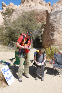 Climbers taking my survey
In 2011, Dr. D'Antonio was awarded a Robert Lee Graduate Student Research Grant from Joshua Tree National Park. Joshua Tree NP is a desert park located in southeastern California (near Palm Springs). Joshua Tree NP has become an extremely popular climbing destination but also has a variety of hiking and nature trails. The project was purely social science and examined climber and hiker perceptions of ecological resource conditions at popular locations within Joshua Tree National Park. Additionally, the survey asked visitors about various characteristics, such as experience in and knowledge of Joshua Tree NP, to see if those characteristics influenced their perceptions.
Key Findings (project report available upon request):
Key Findings (project report available upon request):
- Similar to results from Rocky Mountain NP, visitors' knowledge of the national park they were recreating in and of low-impact practices (like Leave No Trace) were the biggest influence on whether or not they perceived resource impacts.
- As compared to hikers, climbers were more perceptive of subtle resource impacts like soil damage and trampled vegetation.
- As compared to climbers, hikers were more perceptive of off-trail use by other visitors and more likely to view off-trail use as negative.
Grand Teton National Park, Wyoming
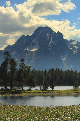 Heron Lake and the Teton Mountains
Project 1: During 2013 and 2014, Dr. D'Antonio managed a project in Grand Teton National Park in Wyoming. This large and interdisciplinary project examined visitor use along the Moose-Wilson Road corridor in the park. The study consisted of GPS tracking of hikers, cars, and bicycles during their visitor to the road corridor and involved mapping resource-related impacts resulting from visitor-created parking areas. In order to measure overall use in the corridor, traffic counting and monitoring techniques were also utilized in the Moose-Wilson Corridor. This project included a collaborative aspect with Penn State University. A social science survey, designed by Penn State, was paired with GPS-tracking methods in an attempt to combine visitor motivations and benefits with visitor behavior. Funding provided by the National Park Service.
Key Findings (All project reports available at Moose-Wilson Planning Website):
Project 2: Rapid, increasing use in a recreation system that has not had that level of use in the past is often a concern for park managers. This is what has happened at Leigh and String Lakes (within recommended Wilderness) in Grand Teton National Park. During the summer of 2016 - with collaborators from Utah State and Penn State - Dr. D'Antonio and Jenna Baker (M.S. student) began a study examining visitor use and resource impacts at String and Leigh Lakes. The study included visitor surveys, GPS-based tracking, observational techniques, transportation measures, and mapped resource impacts in the area. Funding provided by the National Park Service.
Key Findings:
Key Findings (All project reports available at Moose-Wilson Planning Website):
- Total visitor use in the Moose-Wilson corridor has been increasing since 2006.
- The majority of visitors to the Moose-Wilson corridor drive through the corridor without stopping.
- The Laurence S. Rockefeller Preserve and a parking lot bordering a wetland area, known as Sawmill Ponds, are important destinations to visitors to the Moose-Wilson Corridor.
Project 2: Rapid, increasing use in a recreation system that has not had that level of use in the past is often a concern for park managers. This is what has happened at Leigh and String Lakes (within recommended Wilderness) in Grand Teton National Park. During the summer of 2016 - with collaborators from Utah State and Penn State - Dr. D'Antonio and Jenna Baker (M.S. student) began a study examining visitor use and resource impacts at String and Leigh Lakes. The study included visitor surveys, GPS-based tracking, observational techniques, transportation measures, and mapped resource impacts in the area. Funding provided by the National Park Service.
Key Findings:
- We found that the majority of visitors to String and Leigh Lakes, including those on the water, recreate within a relatively small portion of the lake and lakeshore.
- Due to the high concentration of visitor use, resource disturbance and experiential impacts are higher along the South East shoreline of String Lake - resulting in resource disturbance being low in extend but high in intensity.
- Our study purposefully aimed to meaningfully combine both social and geospatial data to inform visitor use management.
Arapaho-Roosevelt National Forest, Colorado
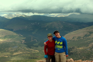 Dr. D'Antonio and field tech, Annie, on the summit of Mt. Bierstadt
During the summer of 2012, Dr. D'Antonio worked on her first project with the USDA Forest Service. The Arapaho-Roosevelt National Forest in Colorado contains two very easily accessed 14,000+ peaks; Mt. Bierstadt and Mt. Evans. Due to the increasing popularity of hiking 14'ers, unattended parking and crowding has become an issue at these popular peaks. An alternative transportation study was conducted in the national forests and Dr. D'Antonio was in charge of examining the existing ecological impacts from visitor use found at Mt. Bierstadt and Mt. Evans. This project was funded by the USDA Forest Service.
Key Findings:
Key Findings:
- The main impacts observed at Mt. Bierstadt were informal trails.
- Very few visitor-created sites were found at any of the study sites, but those that were found were generally highly impacted.
- The main impact at Mt. Evans, was one long and highly impacted informal trail/route that provided an alternative hike to the summit.
Visitor Use Monitoring Projects
Pacific Crest Trail: Dr. D'Antonio works with colleagues at Applied Trails Research to provide visitor use management support to the PCTA and USDA Forest Service.
Capitol Reef National Park, Utah: We worked with CARE to identify indicators of backcountry use and will be developing protocols for monitoring those indicators in 2021 & 2022.
USDA Forest Service - National Wilderness Monitoring Program: During the summer of 2016, Dr. D'Antonio assisted Dr. Troy Hall in developing a minimum protocol for monitoring social trails in designated wilderness. These protocols are used by the USDA Forest Service for their Wilderness Monitoring program.
Golden Gate National Recreation Area, California: Dr. D'Antonio was a co-PI on a project in Golden Gate National Recreation Area in California where we will be helping develop visitor use monitoring protocols.